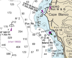
Barry’s uTube link to F/V Rosella being 24.342 nautical miles South from Cape Blanco.
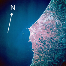
The cape, a relatively level landform with cliffs facing the sea, is about 200 feet (61 m) higher than the ocean. It consists of layers of uplifted marine sediments, ranging in age from 80 million years at the bottom to less than 500,000 years at the top. The uplift is continuing; Cape Blanco is rising by several millimeters each year. Generally, landforms on the north and south end of the Oregon Coast are rising as the ocean floor slides under the continent, while the central part of the coast “seems to be folding down.”
Landforms near the cape include beaches, bluffs, and reefs. Visible to the south are Needle Rock, Blanco Reef, and Humbug Mountain. To the north are Gull Rock, Castle Rock, and Blacklock Point.
 Blanco Reef is a group of irregular rocks and ledges that are from 2 to 5 miles (3 to 8 km) offshore and are up to 149 feet (45 m) high.
Too bad, I just found Barry’s Nautical Chart for the area here. Wonder how he is navigating these waters. I know he does not know how to read the stars. That’s what landlocked Captain Webb told me.
Oregon’s salmon season starts April 1, 2015.
Recent Comments